If you’re visiting for the first time, you probably came here for the lake, but did you know that there’s a rare and spectacular feature that most never visit? It’s the vast, 515 sq. mile (329,600 acre) prairie known as the Zumwalt and its largely pristine and intact.
It’s boundary extends northeast from all the towns in the Wallowa Valley right up to the forests that mark the rim overlooking the Snake River along the Oregon-Idaho border. This once-common landscape covered some 40 percent of the U.S, but today less that 2 percent remains. If you like rolling hills, vast skies, green fields and wildflowers, our prairie environs are sure to impress.

To the north of Wallowa Lake and Joseph lays the heart of the Zumwalt Prairie. The Nature Conservancy holds a significant portion that it considers to be the most pristine of its kind. A small holding within the preserve was even designated as a National Natural Landmark in 2013. To the east lays the Cats Back; a varied, high-mountain summer grazing area.
Both are similar and special in their own way:
- The Zumwalt Preserve has developed trails and a few of the trails have gentle grades making them perfect for a leisurely nature walk. The area around the Preserve is fairly flat with three prominent hills.
- The Cats Back is divided by canyons and a long ridge. The Catsback has only roads (some which may have locked gates) and makes a great place to explore on bike.
The Zumwalt Prairie Preserve

The Zumwalt Prairie once grazed the horses of the Nez Perce. It’s natural inhabitants were Elk, Deer and Buffalo. Today it’s mostly cattle, but sizable herds of Elk still roam the land where it’s not unusual to see as many as 200 at a time. Truth is, the prairie grass needs the grazers just as much as the grazers need the grass; in fact the Nature Conservancy relies on cattle to balance and maintain the preserve.

The preserve provides crucial habitat for endangered ground nesting birds. It also provides a home for one of the west’s largest populations of birds of prey.
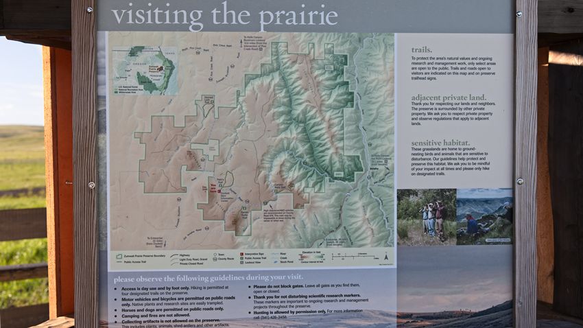
The 33,000 acre preserve has four marked trails that are about 2 miles in length. Its a wonderful place to visit, particularly during the wildflower bloom in mid-April to late June.

Visit The Nature Conservancy Zumwalt Prairie Preserve site for more information.
View the Zumwalt Prairie Panorama.
Directions:
Getting there is pretty straight forward- Set your trip meter at the Joseph Market and head north on Hwy 82 (towards Enterprise) for 2.8 miles and turn right on Crow Creek/Eggleson Ln. Stay on this main/paved road for 5.2 miles till you get to the fork and stay right on to Zumwalt Road. The road will turn to gravel so slow down! The crushed rock in our area forms some wicked shapes (think arrowheads) and slowing down will help save your tires. From here on out you’re in the prairie. Continue another 14 miles just past Findley Buttes and look for the signs to the Zumwalt Prairie Preserve. The parking area has an information kiosk to help you decide which hike to take. Note: No horses, dogs or bicycles are allowed off the main public roads. Travel on trails is by foot only.
The Cats Back

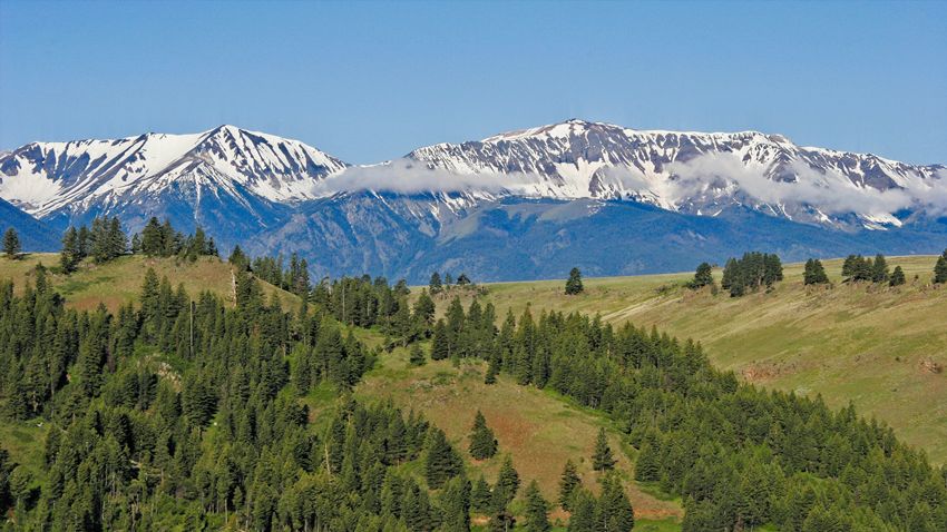
Thirteen miles to the east of Joseph lays the Cats Back. This section of the prairie has an indescribable presence that many visitors are quite taken with- some even consider it their temple! It’s not hard to see why: with its open sky and twin mountain ranges, it certainly fits the description of God’s Country. It’s a quiet and lonely area- the perfect place to get that ‘peaceful, easy feeling.’ In the late 1800’s, the daughter of one of the only families to live on the Cats Back, claimed that if you stayed quiet long enough, you could hear the mountains sing. It’s easy to imagine her time long ago, so little has changed.

Exploring this location can be problematic, mainly because the road conditions vary. You should have good tires, including a good spare and a vehicle with decent clearance. Out further on the dirt roads you can expect to find impassible muddy sections during the wet months. Don't drive off road and don't make the mistake of thinking that your lower-clearance 4WD vehicle won't become high centered if you fall into deeper ruts. Warning: if you get stuck, you might be there overnight! So, come prepared or better yet, just avoid this area until it’s had a chance to dry out. Cellphone coverage is also not guaranteed. While this area can be explored by vehicle, it makes an ideal mountain biking, horseback riding or hiking area.

While the roads are public, the land on all sides is private. During the summer months the area is used to graze livestock and at times you may find gates across the roads- if you open them to pass, just be absolutely sure you close them well. Leave any gates just like you found them!

View the Cats Back Downey Lake Panorama.
Directions:
Head back to Joseph and set your trip meter at the store and turn right and head east towards Imnaha on Hwy 350 for 8.9 miles then turn right on Rail Canyon Road. Proceed slowly on this gravel road; there are a few houses and the residences like their peace and quiet. You’ll come to a switchback that will ascend up a gradually less-improved road that can get pretty bumpy in places. It winds back down through some woods and heads back up again onto the prairie. By this time the road has changed its name to Armin and if you proceed further it will change again to Deadhorse Ridge Road. None of this will matter, as the roads have no signs anyway. Generally you just stick to the road most traveled. If your plan is to hike or mountain bike, anywhere along here would be a good place to pull off and proceed, if not you’ll eventually come to a small corral at the 15.5 mile mark. Proceed another quarter mile and you’ll get to a intersection where you can continue east along Deadhorse Ridge or you could turn north (left) towards Downey Lake.
The road east along Deadhorse Ridge continues another 11 miles until it just ends, and the northern route continues another 4 miles until it picks up Bear Gulch Road. Both are rocky in places and may have swampy spots that pose a real problem getting stuck.